Watershed-Based Plan for the Blackstone River Watershed in MA:
Working together to improve water quality
Introduction
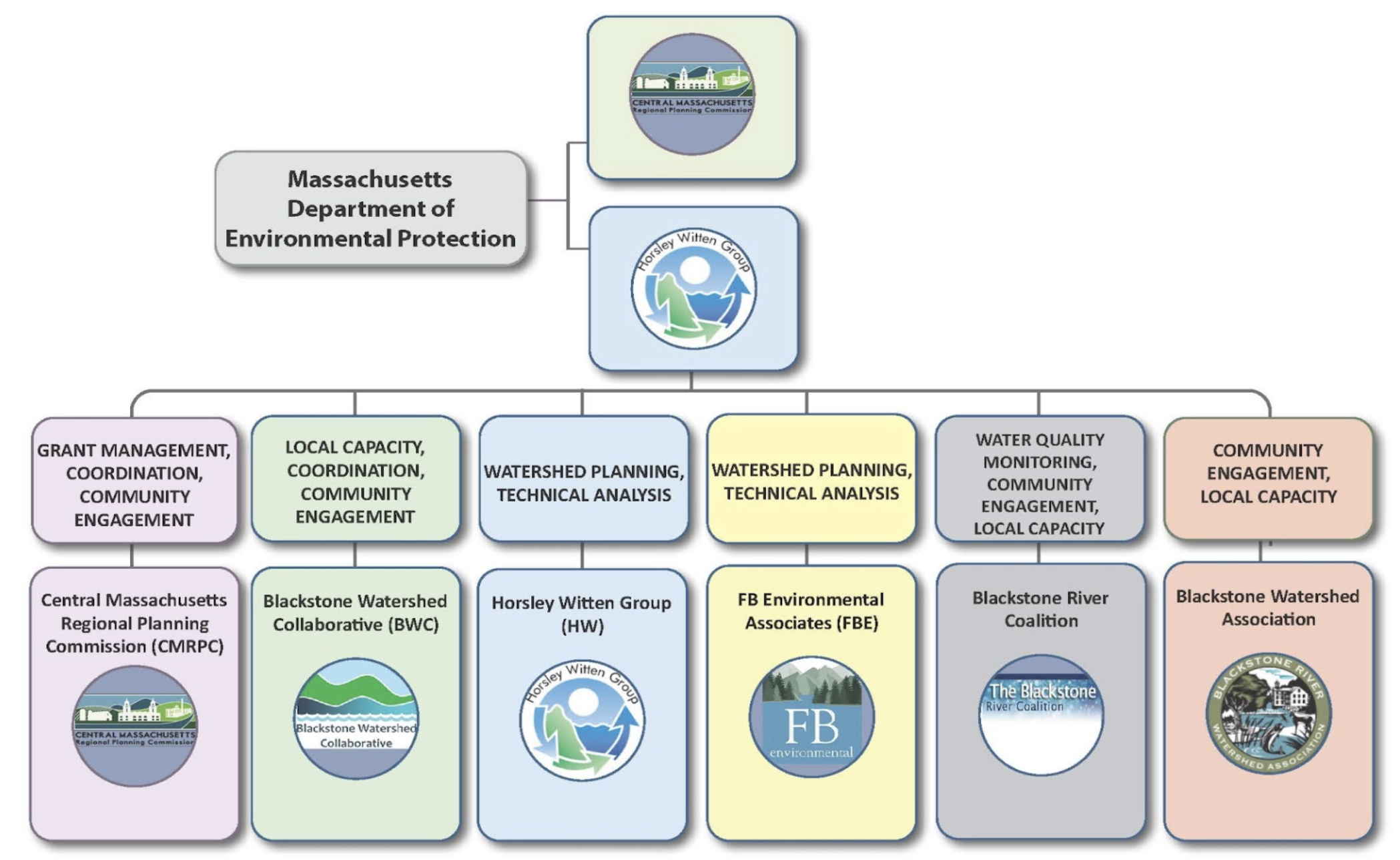
We’re working with our partners at Central Massachusetts Regional Planning Commission (CMRPC), the Blackstone River Coalition (BRC) and the Blackstone River Watershed Association (BRWA), along with Horsley Witten Group and FB Environmental Associates to research and document current conditions around the Blackstone River and identify opportunities to improve water quality in the watershed in MA. Because this funding came through MassDEP, the study will only consider the part of the watershed in MA; however, additional work through the SNEP Network will also explore opportunities for water quality improvement in RI.
The goal of this work is to combine historic research (including over two decades of water quality monitoring from BRC!), current conditions, and public engagement to inform a nine-element Watershed-Based Plan (WBP). This plan will offer comprehensive and quantitative analysis to identify knowledge gaps, characterize watershed conditions and sources of pollution, establish water quality goals, and develop a plan to implement improvements that benefit all 29 municipalities in MA - as well as those downstream.
Funding is provided from MassDEP, under Section 604(b) of the federal Clean Water Act. Once complete, the plan will make communities eligible for Clean Water Act Section 319 Nonpoint Source Grants that offer implementation dollars for addressing nonpoint source pollution. This eligibility will elevate the MA watershed’s 29 communities to a level playing field where all communities are able to seek funding to improve opportunities to implement a shared vision of a healthy river and watershed to benefit the public, the ecosystem, and offer stewardship opportunities for all.
This plan will take an “adaptive management” approach, which means that it’s being made to not just sit on a shelf, but will be created with the plan to revisit and revise it at regular intervals. In the future, our goal is to work with partners to complete detailed plans for other smaller watersheds within the larger Blackstone River Watershed and then stitch together those more detailed subwatershed models and action plans into a comprehensive watershed management plan for the entire Blackstone River Watershed. The current plan will include Blackstone River watershed-wide characterization and action planning, including a roadmap for those future subwatershed-scale plans.
Throughout the project, we’ll be reaching out to local stakeholders from municipalities, tribes, watershed groups, universities, and others in order to build our technical knowledge, incorporate input and guidance from their experiences, and strengthen relationships across the watershed. Our approach aims to create momentum and improve the likelihood of success for future planning and implementation efforts.
We’ll be sharing opportunities for public input throughout the project, including meetings, workshops, and review of draft findings. You can sign up for our newsletter or reach out directly to learn more and stay connected.
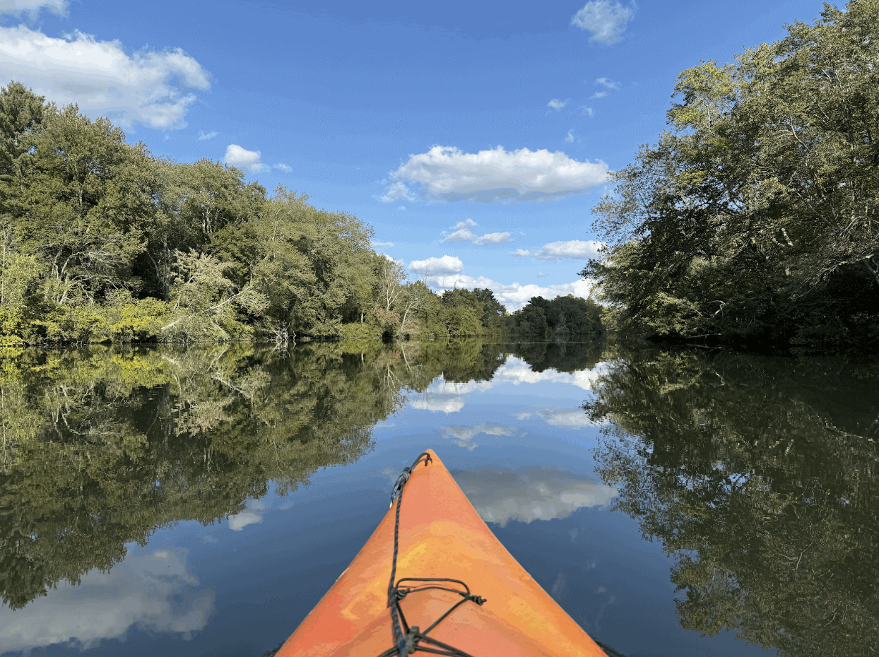
The Blackstone Watershed offers wonderful opportunities for recreation, including this flatwater stretch of the Blackstone River in the town of Blackstone, MA (September 2025)
Frequently Asked Questions
-
A Nine-Element Watershed-Based Plan is an EPA-approved, community-informed, science-based guide that helps identify where pollution is coming from and what actions can improve water quality and aquatic habitat. It brings together data, modeling, and local knowledge to set measurable goals and outline practical, high-impact projects that communities can advance over time.
These plans can be done at many different scales, such as for an individual pond, a municipality, or at the larger watershed scale. This Blackstone WBP will be high-level throughout the 29 communities in MA and identify areas for improvement, but due to the scale and level of funding available, it will not zoom into site-specific challenges and solutions. The project team hopes that this will be a first step and future WBPs will be created at smaller subwatershed scales once this first plan is completed.
The nine elements of a WBP as described and required by EPA are as follows:
An identification of the causes and sources or groups of similar sources that will need to be controlled to achieve the load reductions estimated in this watershed-based plan (and to achieve any other watershed goals identified in the watershed-based plan), as discussed in item (b) immediately below.
An estimate of the load reductions expected for the management measures described under paragraph (c) below (recognizing the natural variability and the difficulty in precisely predicting the performance of management measures over time).
A description of the NPS management measures that will need to be implemented to achieve the load reductions estimated under paragraph (b) above (as well as to achieve other watershed goals identified in this watershed-based plan), and an identification (using a map or a description) of the critical areas in which those measures will be needed to implement this plan.
An estimate of the amounts of technical and financial assistance needed, associated costs, and/or the sources and authorities that will be relied upon, to implement this plan. As sources of funding, States should consider the use of their Section 319 programs, State Revolving Funds, USDA's Environmental Quality Incentives Program and Conservation Reserve Program, and other relevant Federal, State, local and private funds that may be available to assist in implementing this plan.
An information/education component that will be used to enhance public understanding of the project and encourage their early and continued participation in selecting, designing, and implementing the NPS management measures that will be implemented.
A schedule for implementing the NPS management measures identified in this plan that is reasonably expeditious.
A description of interim, measurable milestones for determining whether NPS management measures or other control actions are being implemented.
A set of criteria that can be used to determine whether loading reductions are being achieved over time and substantial progress is being made towards attaining water quality standards and, if not, the criteria for determining whether this watershed-based plan needs to be revised or, if an NPS total maximum daily load (TMDL) has been established, whether the NPS TMDL needs to be revised.
A monitoring component to evaluate the effectiveness of the implementation efforts over time, measured against the criteria established under item (h) immediately above.
-
604(b) refers to the section of the federal Clean Water Act that provides funding for states to conduct watershed-based planning. In Massachusetts, MassDEP administers the 604(b) grant to eligible entities to determine the nature, extent, and causes of water quality issues and to develop plans to restore or protect water quality pursuant to the federal Clean Water Act and Massachusetts Surface Water Quality Standards.
-
The Nine-Element Watershed-Based Plan will provide:
A summary of current watershed and water quality conditions
Identification of data gaps and pollution sources
Water quality goals for the watershed
A prioritized list of types of projects and actions communities can take
Recommendations for future subwatershed plans and ongoing updates
A shared vision for water quality improvements throughout the Massachusetts portion of the watershed to catalyze action and habitat restoration
Once the plan is in place, all Massachusetts municipalities and tribes in the Blackstone Watershed will be eligible to pursue 319 Nonpoint Source Grants for implementation of water quality improvement projects.
-
The plan will work with communities to identify overlapping priorities and give them shared data, tools, and project ideas that support restoration and resilience goals. Once approved, it will also make every Massachusetts community in the watershed eligible to apply for implementation through Clean Water Act Section 319 Nonpoint Source Grants, opening the door to new funding that can support green infrastructure, stream restoration, erosion control, and other on-the-ground improvements. Additionally, this information can be used to support projects funded through other sources such as the Municipal Vulnerability Preparedness (MVP) Program or the Division of Ecological Restoration (DER) by demonstrating potential co-benefits to water quality and habitat improvement.
-
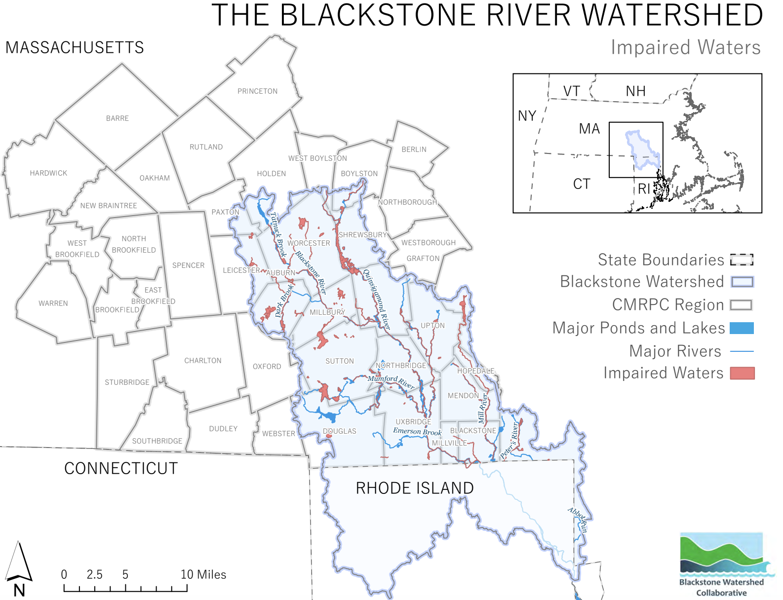
A waterbody is considered “impaired” when it does not meet state or federal water quality standards for uses like recreation, aquatic life, or supporting healthy fish populations. According to MassDEP’s 2022 Integrated List of Waters (sometimes called the 303(d) list), the entire Massachusetts stretch of the Blackstone River (segments MA51-03 through MA51-06) is listed as impaired. This status reflects a combination of degraded water quality, altered river conditions, and habitat decline identified in the watershed-based planning work.
The most recent data presented through BRC’s 2024 Water Quality Report Card shows that the headwaters suffer mainly from aesthetics, turbidity, trash, erosion, and water odor. While nitrates and orthophosphates in the river have decreased over time, their amount still exceeds healthy levels. Some of the river’s tributaries are also considered impaired, while others are not, as shown in the map above.
Key impairments affecting the river and its tributaries include:
Excess nutrients (nitrogen and phosphorus) that continue to exceed healthy thresholds and contribute to algae growth and low oxygen;
Contaminated sediments from the region’s industrial past that still store heavy metals and other pollutants in banks and riverbed deposits;
Elevated water temperatures, which are increasing over time and reducing suitable habitat for cold-water species;
Degraded habitat and physical conditions, including hardened riverbanks, disconnected floodplains, erosion, turbidity, and invasive plant species;
Obstructed river flow from more than 300 dams and 2,500 culverts limiting natural movement of water, slowing and warming the river, and blocking fish passage; and
Water quality impacts from storm events, including flashy water levels, stagnation, and reduced oxygen.
Together, these impairments mean the river does not currently meet standards for aquatic life and other designated uses, even as long-term restoration efforts continue to improve overall conditions. Currently, the watershed retains a diverse landscape which offers significant habitat value and hosts large intact forests and over 140 miles of cold-water fisheries in MA alone and is a recreational resource for kayakers, birders, hikers, fisherfolk, and others. It is home to 36 species of freshwater fish and estuarine species like striped bass, bluefish, and menhaden as well as dozens of mammal and bird species, including Bald Eagles.
-
Water quality in the Blackstone River and watershed has seen immense improvements over the past 50 years. In the 1970s, it was considered a “dead” river that didn’t support life due to the historic industrial contamination from mills along its banks for hundreds of years. However, through strategic investments in wastewater treatment, community actions to reduce stormwater pollution and decades of strong advocacy from partner organizations, the river is an amazing resource for both passive recreation, such as kayaking,as well as home to dozens of wildlife species.
You can learn more about water quality from our partners at the Blackstone River Coalition, who have over 20 years of water quality monitoring data from over 70 sites on the mainstem and its tributaries. This data will be a crucial baseline for the watershed-based plan to build from.
-
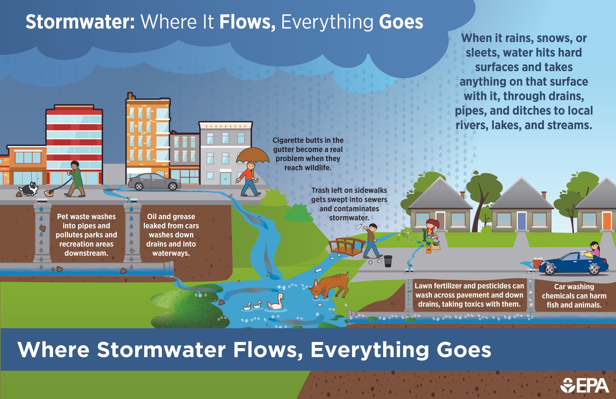
The primary source of pollution in the Blackstone Watershed is stormwater runoff—rainfall that flows across roads, parking lots, rooftops, large solar arrays, and other hard surfaces. As it moves, stormwater collects pollutants such as nutrients, sediment, trash, oils, and metals and carries them into nearby streams and the Blackstone River via drainage pipes, often without treatment.
Additional major pollution sources include:
Combined Sewer Overflows (CSOs) in Worcester, where heavy storms can cause wastewater and stormwater to enter the river. In 2023, this totaled 227 million gallons across 30 events.
Nutrient inputs from non-point sources such as fertilizers, failing septic systems, and small scale wastewater systems that add nitrogen and phosphorus to the river.
Legacy industrial contamination, where historical manufacturing left behind heavy metals and other pollutants stored in riverbank and bottom sediments.
Erosion and sediment inputs from disturbed soils, degraded banks, and altered land uses.
Even with these ongoing pollution sources, decades of monitoring and community-led restoration have supported steady progress toward cleaner water and a healthier, more resilient river system.
-
EPA’s Section 319 Nonpoint Source Grants are funneled through the states, territories, and tribes to support implementation projects that improve water quality. In Massachusetts, this funding is then competitively awarded to projects that help communities reduce nonpoint source pollution—pollution that comes from many diffuse places, like stormwater, failing infrastructure, historic contamination, or disturbed land.
In Massachusetts, communities can use 319 funds for “implementation projects that address the prevention, control, and abatement of nonpoint source (NPS) pollution.” These projects could include:
Green stormwater infrastructure
Streambank and floodplain restoration
Agricultural and land management practices
Stormwater retrofits and treatment systems
To apply for 319 funding, communities must have an approved Nine-Element Watershed-Based Plan that identifies local water quality challenges and outlines specific actions. That is the plan we are developing through this project.
-
Because this project is funded through MassDEP, this plan’s scope includes only the Massachusetts portion of the watershed. However, we understand the need to think watershed-wide across both states and are coordinating with the Southeast New England Program (SNEP) Network and the University of New Hampshire Stormwater Center to use available Hydrologic Response Unit (HRU) mapping to inform water quality goals and potential projects on the RI side of the watershed.
HRU mapping is a way to map the landscape using land use and land cover, soil type, and other unique variables to analyze runoff and pollutant loading at different geographic scales. You can learn more about HRU mapping in this webinar, mapping platform, or technical report.
-
Central Massachusetts Regional Planning Commission (CMRPC) – Project lead and grant administrator
Horsley Witten Group and FB Environmental Associates – Technical analysis and watershed modeling, plan development
Blackstone Watershed Collaborative – Outreach, coordination, and partner engagement
Blackstone River Coalition (BRC) – Water quality monitoring and long-term data analysis
Blackstone River Watershed Association (BRWA) – Community engagement and public education
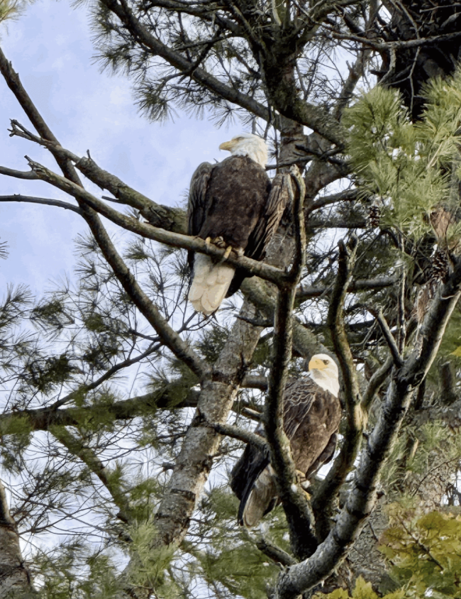
The river and its watershed offer excellent habitat for numerous species, including this nesting pair of bald eagles frequently seen along the river in Massachusetts.

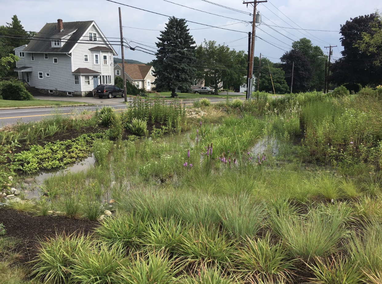
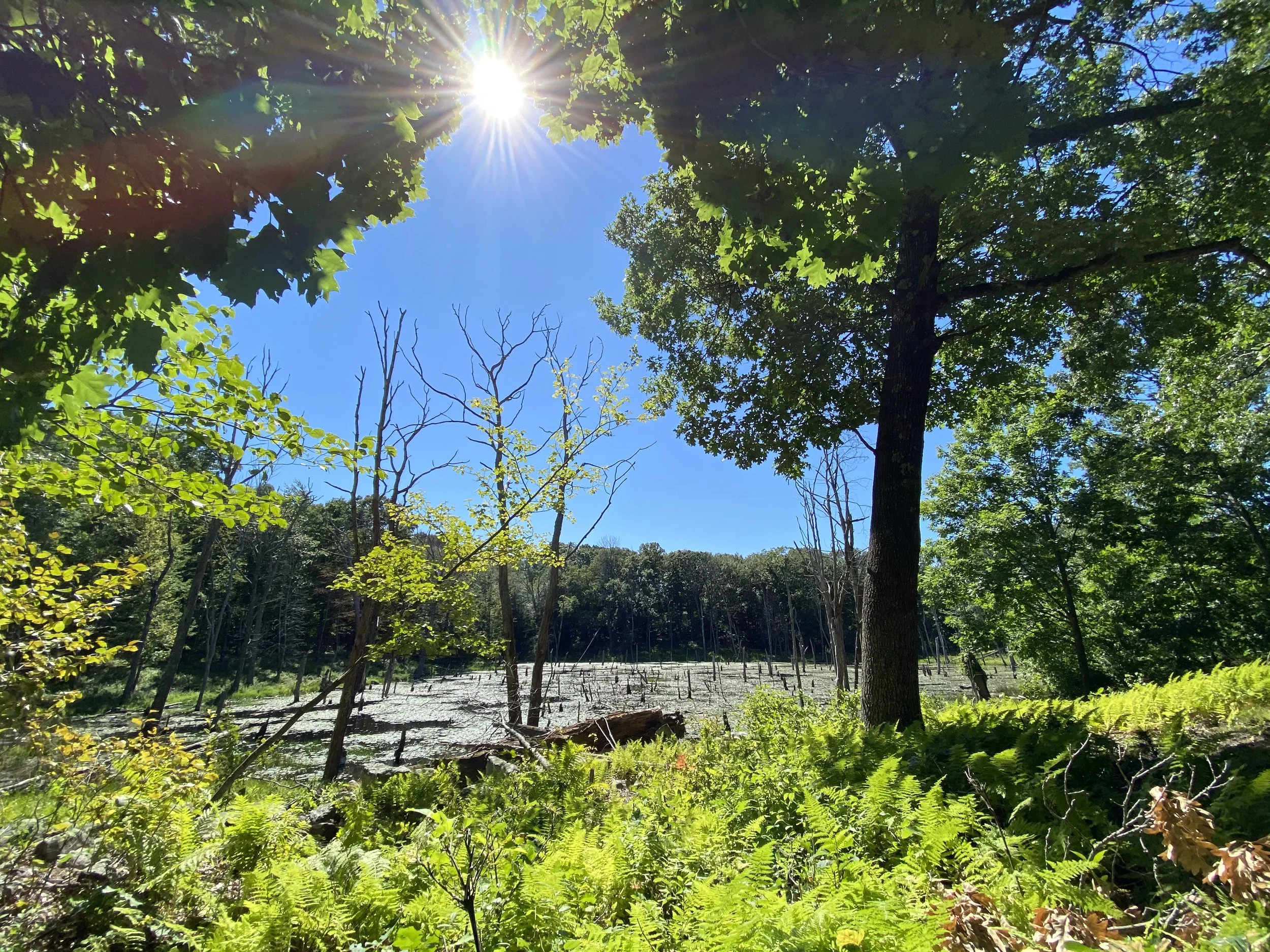
Natural wetlands such as this one in Worcester offer natural opportunities to offer numerous co-benefits such as filtering water, reducing flooding, offering habitat for diverse species, providing recreational opportunities, and more.
319 funding can be used for implementation projects such as installation of rain gardens like this one at Mass Audubon’s Broad Meadow Brook Wildlife Sanctuary in Worcester, MA
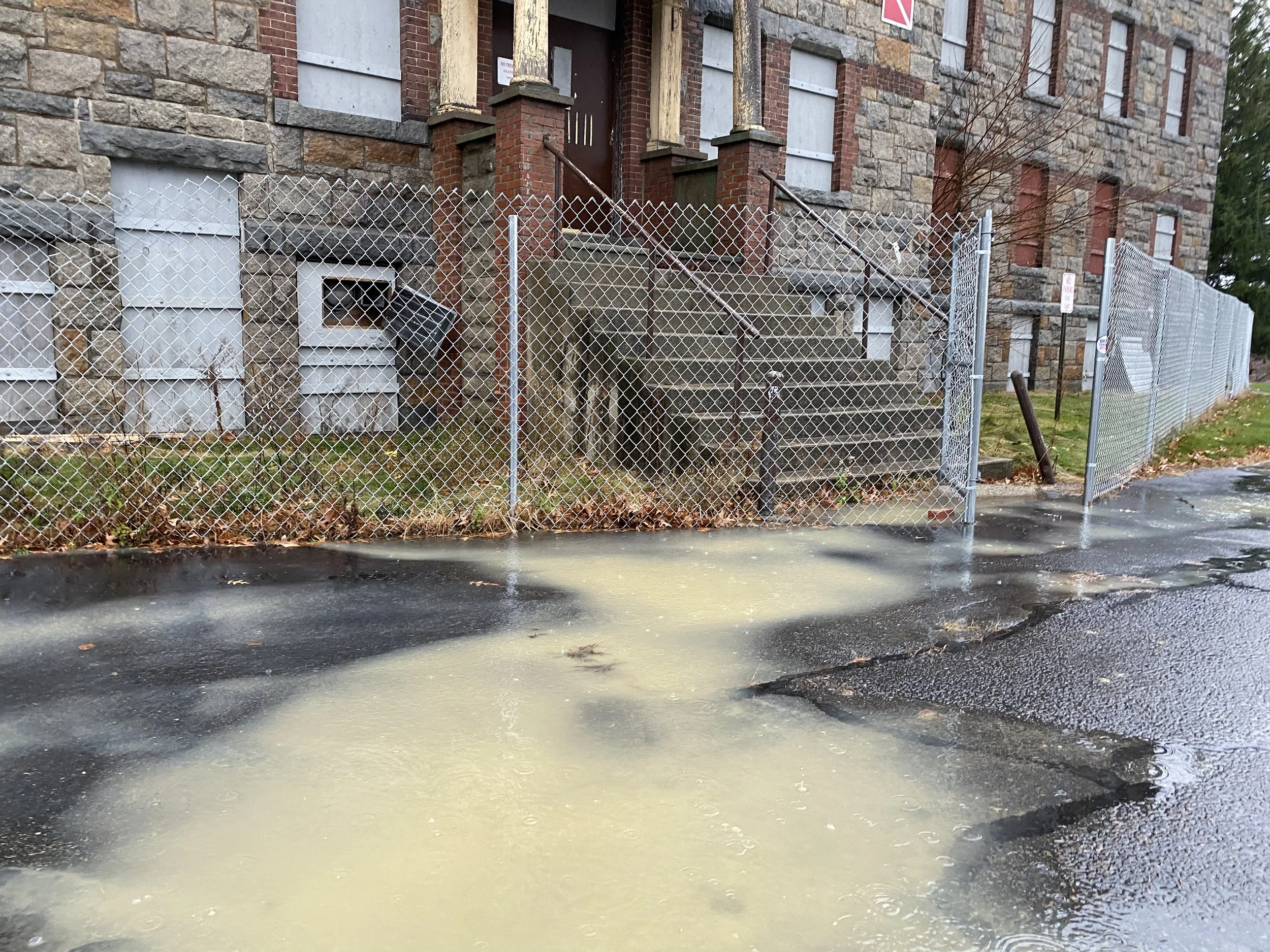
Stormwater runoff from construction sites and other land uses without appropriate erosion control barriers are one source of nonpoint pollution. Because this WBP will be more high-level at a large scale, it will look at categories of impacts rather than site-specific or temporary impacts such as this.
About the Watershed
Located in the traditional, ancestral, unceded territory of the Narragansett, Nipmuc, Pokanoket, and Wampanoag Nations, the Blackstone River spans the Massachusetts/Rhode Island border and is one of the two main tributaries to the Narragansett Bay. It is known to the Nipmuc as Kittacuck, and to the Narragansett as Mishkittakooksepe - both meaning “great tidal river” - although it hasn’t been tidal for over 200 years. The river’s headwaters begin in the hills northwest of Worcester, and the main stem flows 48 miles south into RI, dropping 438’ along the way.
The MA portion of the watershed comprises 335 square miles over 24 river miles, along with a human-made canal running alongside and connecting into the river. The headwater tributaries are the Kettle, Tatnuck, Beaver, Mill, and Broad Meadow Brooks as well as the Middle River within the City of Worcester, which is over 25% impervious and contributes extensive stormwater and combined sewer overflow into the river and downstream communities. Major tributaries include the Quinsigamond, West, Mumford, Mill, and Peters Rivers. However, the watershed also includes numerous areas of large forests and farms.
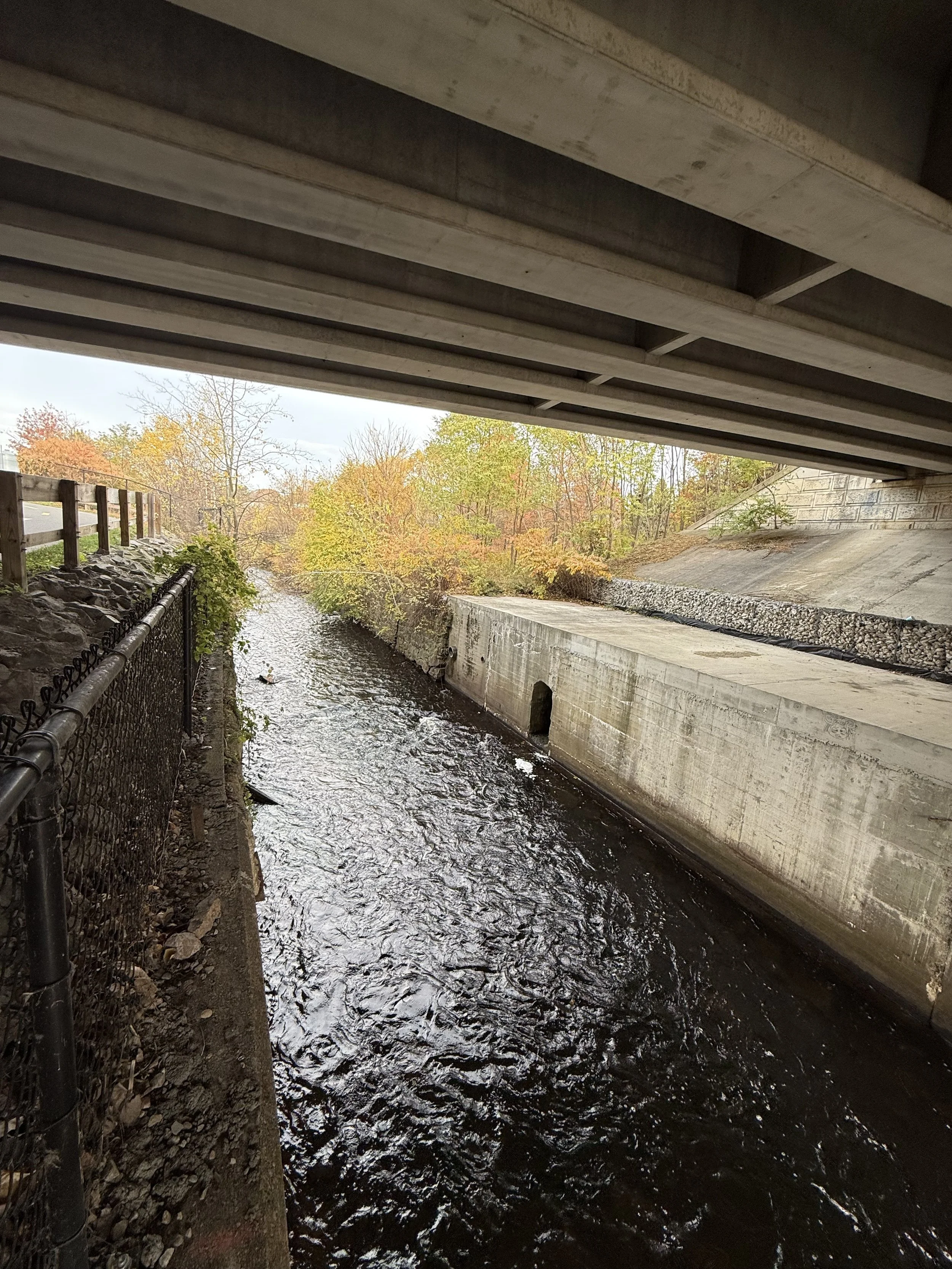
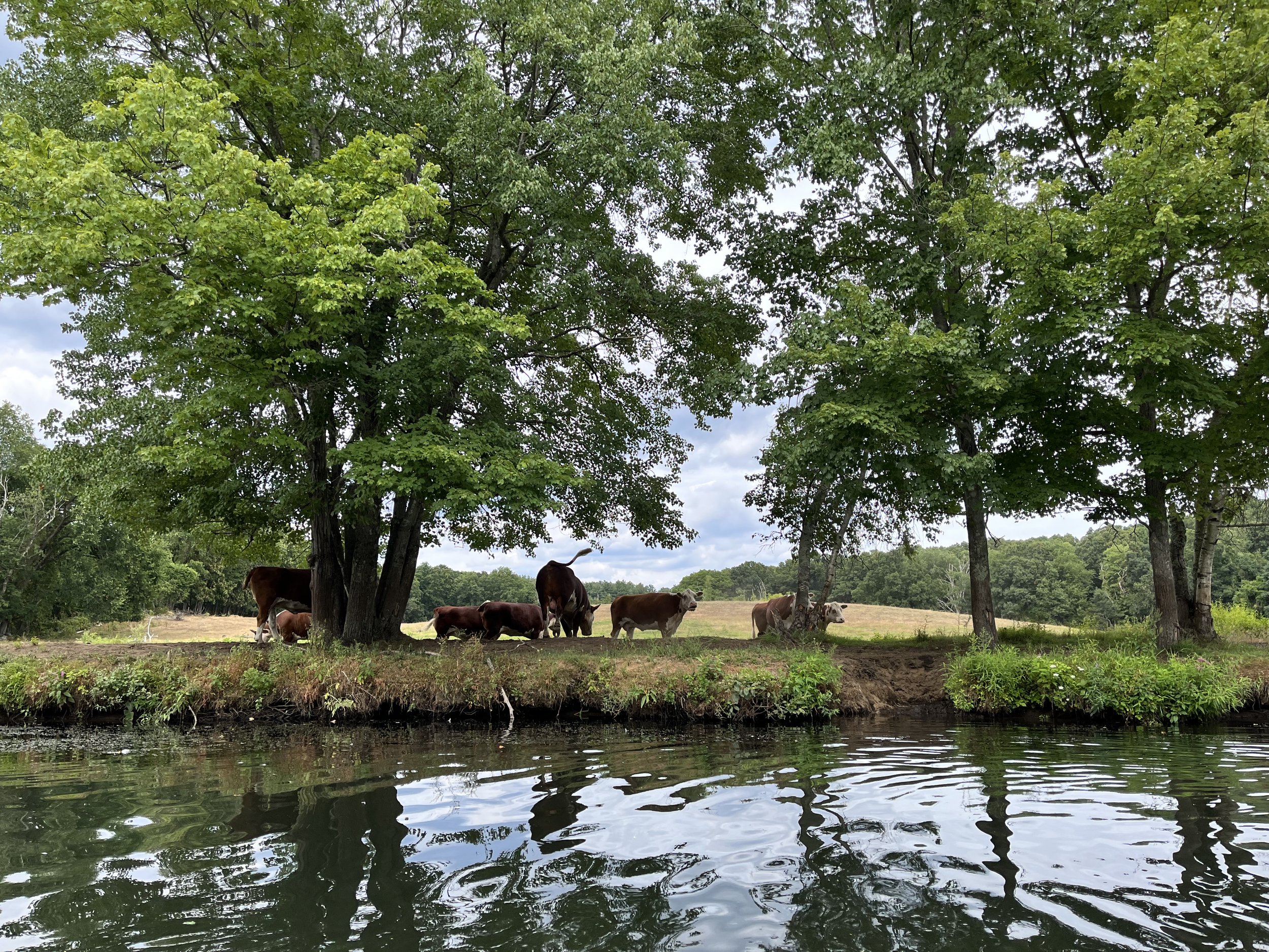
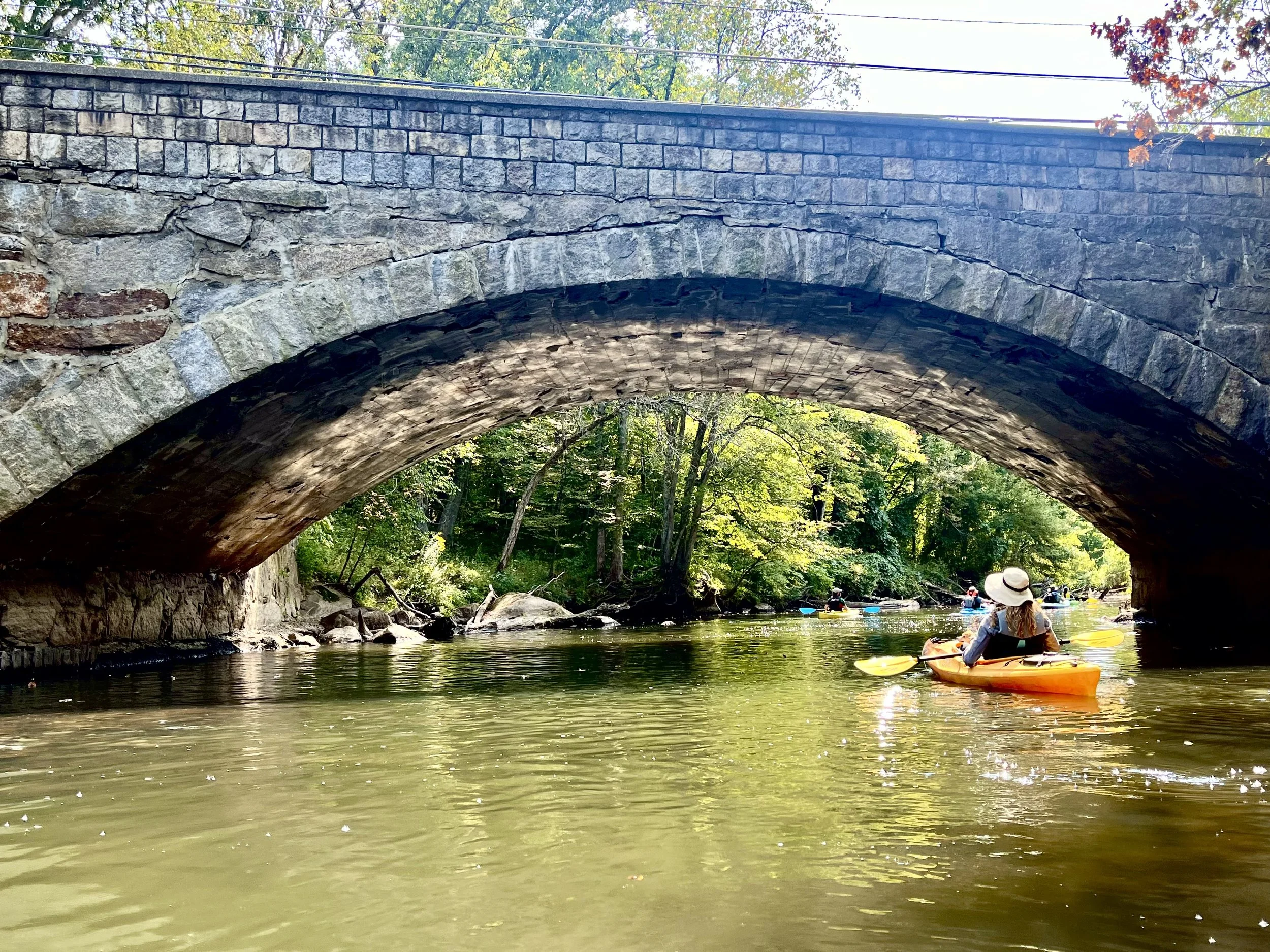
The Blackstone River looks very different depending on which section you’re in! It is a diverse watershed that includes both highly urbanized and channelized areas such as the first image in Worcester; working farms such as the second image in Sutton, MA; and many others where infrastructure and the river meet, such as the third image from Northbridge.